Rip Curl Pro Bells Beach Forecast Update
While the swell was a full, slow 2 feet+ when the Rip Curl Pro waiting period began today, it is somewhat perplexing that the WSL didn’t pull the trigger and immediately push through the (throw-away) first round. The future doesn’t look good, so sometimes it’s best to make the most of what little is available. The coming week seems to remain generally average but there can be a couple of possibilities to be a windy and raw weekend of mid-period south-southwest swell. The Final days are looking more promising as touched on in the early forecast.
Rip Curl Pro Bells Beach Forecast Update
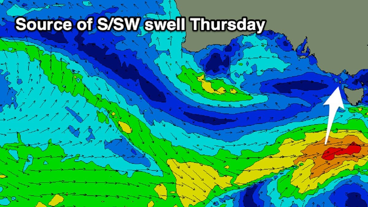
The sluggish swell from today will continue to diminish tomorrow due to an onshore, south-southeast flow, so it will be another lay day. A fun-sized mid-period wave that will rise to 3 feet over the day plus the possibility of a rare bigger one make Thursday a fascinating day. This will be caused by a front that will be well-positioned in Victoria’s southern swell window today, and the southerly wind direction will help with consistency and shape. Additionally, the wind conditions are improving, with a moderate offshore northerly breeze shifting to the northeast throughout the morning in front of feeble sea breezes. We all can expect the fun waves at Rincon through the morning and Winki all day with light winds.
We could expect a rest day on Friday as the swell drops to less than 2 feet (+) and fresher northerly winds develop ahead of a southwest change in the afternoon. The weekend will see the development of a strong south-westerly wind as a polar front mixes with an eastward-moving mid-latitude low. We’ll see some significant, localized mid-period S/SW swell building on Saturday, culminating Sunday afternoon to 4-5ft+ but with choppy, harsh conditions thanks to the southwest wind. Wind speeds will be slightly below gale force.
On Monday, another likely lay day, winds will decrease but remain onshore off of the south-southwest. Tuesday will bring marginally cleaner conditions and ease 2-3 foot surf. Wednesday appears to be clear, but swell activity will be at a low point with patchy background groundswell expected to maintain 2 to sometimes 3-foot sets. A strong polar low that forms this weekend over the Heard Island region will cause a larger groundswell to strike the state as we approach the last two days of the waiting period. Gale-force winds should develop in our western swell window, to the southwest of Western Australia, early next week, while the strongest global forecasting models are still at odds with the low’s initial strength in our distant swell window.


